


© 2016 Flying Toucans
Location
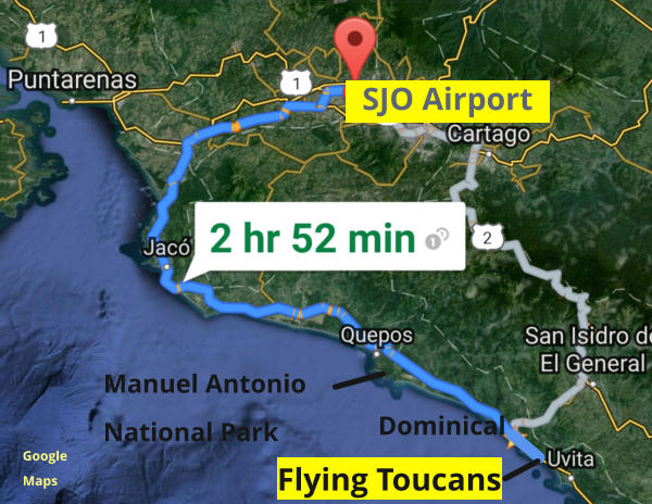
Flying Toucans is located approximately three hours from Costa Rica’s Juan Santamaria Airport (SJO) located in Alajuela.Costa Rica is located in Central America between the countries
of Nicaragua to the north and Panama to the south. It
should not be confused with the island of Puerto Rico
located in the Caribbean.
Flying to Costa Rica
SJO is in the town of Alajuela, about 10 miles northwest of the busy capitol city of San Jose. Most of our guests arrive at SJO and immediately head to Flying Toucans. Depending on your flight schedule, you can get a domestic flight from SJO down to the tiny airport in Quepos which is about 30-40 minutes north of Flying Toucans. You can rent a car in Quepos. (However, be aware that there are serious weight limitations on luggage on these small planes.) There are also some international flights that fly into Liberia located about 5 hours north of us.
Click map for larger image
Driving to Flying Toucans
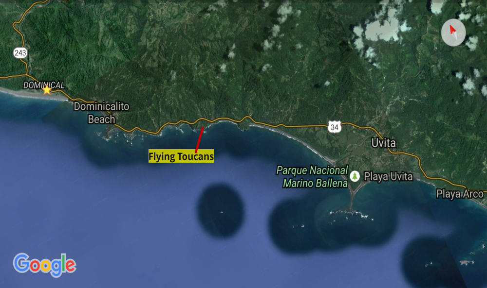
We highly encourage renting a car at the airport to allow flexibility in discovering the richness of not only the beautiful area around Flying Toucans, but other parts of the country as well. See our FAQ page regarding car rental specifics. We recommend the Coastal Route (shown in blue on map) as it offers the easiest and quickest trip passing through the towns of Jaco (famous for surfing) and Quepos (famous for Manuel Antonio National Park) before reaching Dominical. The Mountain Route (shown in gray) passes through over the Cerro de la Muerte before reaching Dominical. Not recommended due to taking more than 4 hours, being very curvy and challenging to drive. Flying Toucans is located six miles south of Dominical on the ocean side of the Coastanera Sur (the main road connecting Costa Rica to neighboring countries of Nicaragua and Panama). We are easily accessed by 2-wheel drive vehicles year-round.
We are located:
1 ½ hours south of Jaco 30-40 minutes south of Quepos 6 miles south of Dominical village 5 miles north of Uvita 2 hours north of Panama border 6 hours south of Nicaragua border